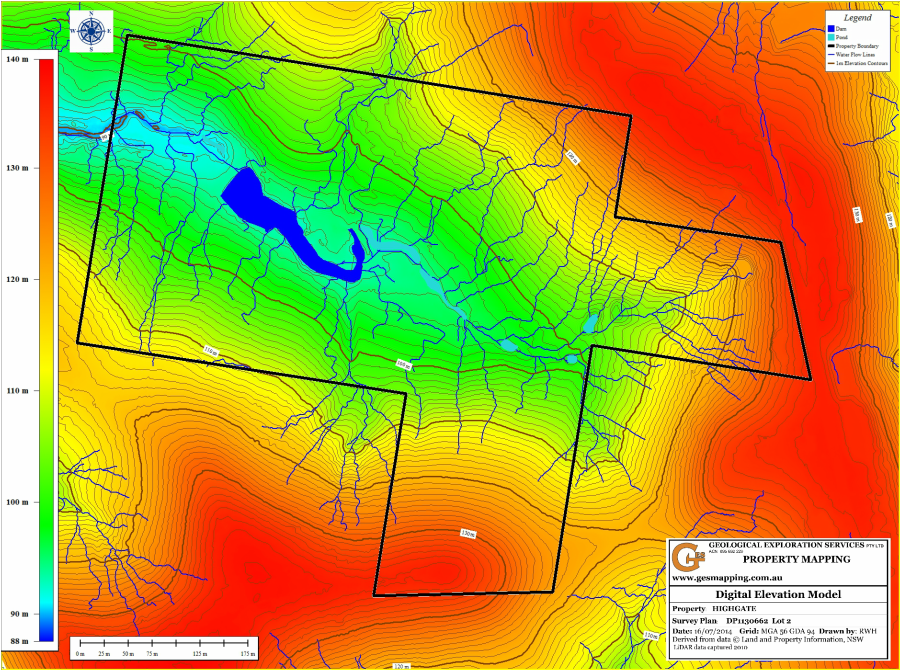
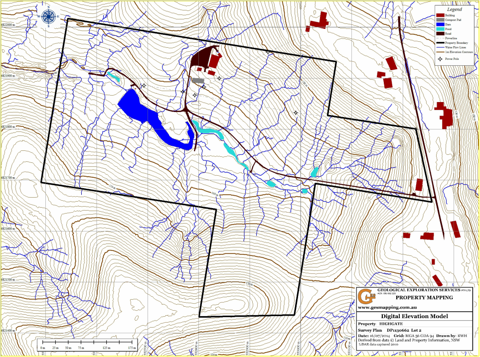
Digital Elevation Model
The strength of LIDAR is its ability to provide accurate elevation data over large areas unsurpassed by any other technique. This data can be used to construct Digital Elevation Models and elevation contours. Engineering quality contours can be generated from 20cm intervals. Elevation of the land is closely related to soil moisture.
The data can be presented in numerous formats. The examples below include 1m contours and a shaded relief map.