Home
What is LiDAR
LiDAR Coverage
LiDAR Coverage
NSW
Qld
The advantage of digital maps
Map Gallery
Products
Products
Location 1:250,000 scale
Location 1:25,000 scale
>
Historical Parish Map
Farm Plan
DP Plan / Survey Plan
Orthophoto Map
Digital Elevation Model
Slope Map
Aspect Map
Geology
Soil Map
Landscape Map
Flow Accumulation
Water Catchment
Flow Direction
Revised Universal Soil Loss Equation
Erosion Potential
Flood Map
Vegetation
Canopy Height
Lidar Ground Point Density
Canopy Intensity
Tree Block Map
Tree Variety Map
3D models
Prices
Contact
Using the maps for farm productivity
Examples
Downloads
Geology
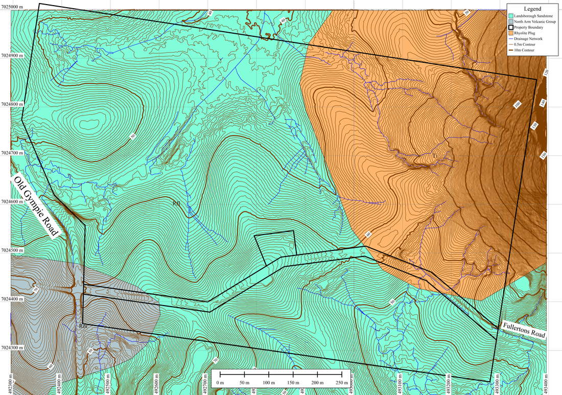
Geological maps using available geological data can be generated for individual properties. The scale of the map depends on the variability of geological units on a farm scale or local scale (25k).
Home
What is LiDAR
LiDAR Coverage
LiDAR Coverage
NSW
Qld
The advantage of digital maps
Map Gallery
Products
Products
Location 1:250,000 scale
Location 1:25,000 scale
>
Historical Parish Map
Farm Plan
DP Plan / Survey Plan
Orthophoto Map
Digital Elevation Model
Slope Map
Aspect Map
Geology
Soil Map
Landscape Map
Flow Accumulation
Water Catchment
Flow Direction
Revised Universal Soil Loss Equation
Erosion Potential
Flood Map
Vegetation
Canopy Height
Lidar Ground Point Density
Canopy Intensity
Tree Block Map
Tree Variety Map
3D models
Prices
Contact
Using the maps for farm productivity
Examples
Downloads