Geological Exploration Services
  • Home
  • What is LiDAR
  • LiDAR Coverage
    • LiDAR Coverage
    • NSW
    • Qld
  • The advantage of digital maps
  • Map Gallery
  • Products
    • Products
    • Location 1:250,000 scale
    • Location 1:25,000 scale >
      • Historical Parish Map
    • Farm Plan
    • DP Plan / Survey Plan
    • Orthophoto Map
    • Digital Elevation Model
    • Slope Map
    • Aspect Map
    • Geology
    • Soil Map
    • Landscape Map
    • Flow Accumulation
    • Water Catchment
    • Flow Direction
    • Revised Universal Soil Loss Equation
    • Erosion Potential
    • Flood Map
    • Vegetation
    • Canopy Height
    • Lidar Ground Point Density
    • Canopy Intensity
    • Tree Block Map
    • Tree Variety Map
    • 3D models
  • Prices
  • Contact
  • Using the maps for farm productivity
  • Examples
  • Downloads
Depositional Plan

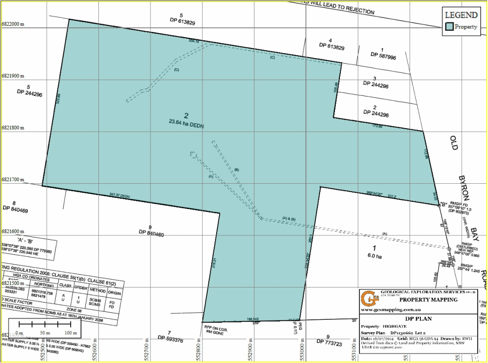
The Depositional Plan (NSW) or Survey Plan (Qld) is the legal survey of a property. In NSW all DP plans are connected to the State Survey control network. Only the more recent plans (since 2004) are also linked to the MGA. The older survey plans can generally be merged with LIDAR data by using fence-lines. The map shows infrastructure location in relation to the survey boundary.

Map features include including:-
  • copy of DP plan
  • surveyed property boundary
  • 100m MGA grid
  • optional - infrastructure (roads, buildings) 
Picture
  • Home
  • What is LiDAR
  • LiDAR Coverage
    • LiDAR Coverage
    • NSW
    • Qld
  • The advantage of digital maps
  • Map Gallery
  • Products
    • Products
    • Location 1:250,000 scale
    • Location 1:25,000 scale >
      • Historical Parish Map
    • Farm Plan
    • DP Plan / Survey Plan
    • Orthophoto Map
    • Digital Elevation Model
    • Slope Map
    • Aspect Map
    • Geology
    • Soil Map
    • Landscape Map
    • Flow Accumulation
    • Water Catchment
    • Flow Direction
    • Revised Universal Soil Loss Equation
    • Erosion Potential
    • Flood Map
    • Vegetation
    • Canopy Height
    • Lidar Ground Point Density
    • Canopy Intensity
    • Tree Block Map
    • Tree Variety Map
    • 3D models
  • Prices
  • Contact
  • Using the maps for farm productivity
  • Examples
  • Downloads