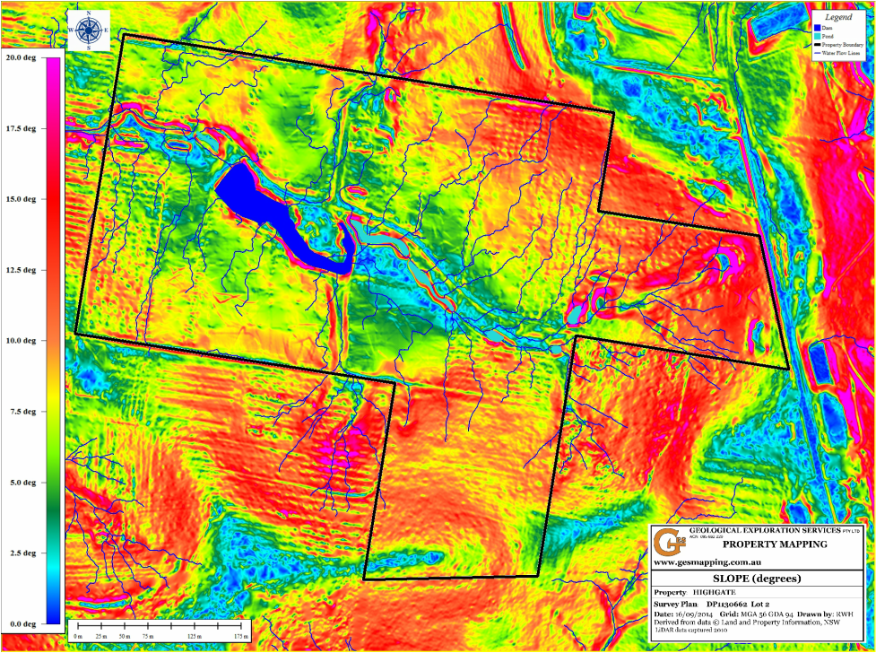
Geological Exploration Services
  • Home
  • What is LiDAR
  • LiDAR Coverage
    • LiDAR Coverage
    • NSW
    • Qld
  • The advantage of digital maps
  • Map Gallery
  • Products
    • Products
    • Location 1:250,000 scale
    • Location 1:25,000 scale >
      • Historical Parish Map
    • Farm Plan
    • DP Plan / Survey Plan
    • Orthophoto Map
    • Digital Elevation Model
    • Slope Map
    • Aspect Map
    • Geology
    • Soil Map
    • Landscape Map
    • Flow Accumulation
    • Water Catchment
    • Flow Direction
    • Revised Universal Soil Loss Equation
    • Erosion Potential
    • Flood Map
    • Vegetation
    • Canopy Height
    • Lidar Ground Point Density
    • Canopy Intensity
    • Tree Block Map
    • Tree Variety Map
    • 3D models
  • Prices
  • Contact
  • Using the maps for farm productivity
  • Examples
  • Downloads
Slope Map

The slope map defines areas of equal gradient. The slope gradient has significant impacts on land-use due to amount and rate of water run-off affecting soil loss and water storage.  The depth of soil is often related to the slope which defines the site as erosional or depositional.

The map can be used together with the drainage network to improve the layout of paddocks and design contour banks to reduce water erosion. Useful for planning farm activities that need to avoid the steeper slopes.
Picture
  • Home
  • What is LiDAR
  • LiDAR Coverage
    • LiDAR Coverage
    • NSW
    • Qld
  • The advantage of digital maps
  • Map Gallery
  • Products
    • Products
    • Location 1:250,000 scale
    • Location 1:25,000 scale >
      • Historical Parish Map
    • Farm Plan
    • DP Plan / Survey Plan
    • Orthophoto Map
    • Digital Elevation Model
    • Slope Map
    • Aspect Map
    • Geology
    • Soil Map
    • Landscape Map
    • Flow Accumulation
    • Water Catchment
    • Flow Direction
    • Revised Universal Soil Loss Equation
    • Erosion Potential
    • Flood Map
    • Vegetation
    • Canopy Height
    • Lidar Ground Point Density
    • Canopy Intensity
    • Tree Block Map
    • Tree Variety Map
    • 3D models
  • Prices
  • Contact
  • Using the maps for farm productivity
  • Examples
  • Downloads