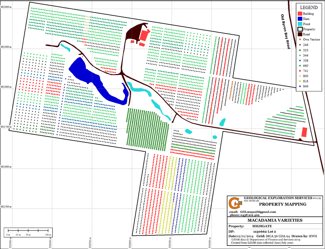
Home
What is LiDAR
LiDAR Coverage
LiDAR Coverage
NSW
Qld
The advantage of digital maps
Map Gallery
Products
Products
Location 1:250,000 scale
Location 1:25,000 scale
>
Historical Parish Map
Farm Plan
DP Plan / Survey Plan
Orthophoto Map
Digital Elevation Model
Slope Map
Aspect Map
Geology
Soil Map
Landscape Map
Flow Accumulation
Water Catchment
Flow Direction
Revised Universal Soil Loss Equation
Erosion Potential
Flood Map
Vegetation
Canopy Height
Lidar Ground Point Density
Canopy Intensity
Tree Block Map
Tree Variety Map
3D models
Prices
Contact
Using the maps for farm productivity
Examples
Downloads
Tree Variety Map
LIDAR assists greatly in accurately locating all plantation trees on a property. A farmers input is required to classify the different varieties. The resultant map is very handy for farm planning and recording production.
Home
What is LiDAR
LiDAR Coverage
LiDAR Coverage
NSW
Qld
The advantage of digital maps
Map Gallery
Products
Products
Location 1:250,000 scale
Location 1:25,000 scale
>
Historical Parish Map
Farm Plan
DP Plan / Survey Plan
Orthophoto Map
Digital Elevation Model
Slope Map
Aspect Map
Geology
Soil Map
Landscape Map
Flow Accumulation
Water Catchment
Flow Direction
Revised Universal Soil Loss Equation
Erosion Potential
Flood Map
Vegetation
Canopy Height
Lidar Ground Point Density
Canopy Intensity
Tree Block Map
Tree Variety Map
3D models
Prices
Contact
Using the maps for farm productivity
Examples
Downloads