
|
Topography
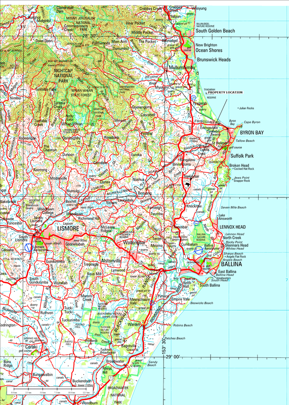
Your property located on a regional scale map |
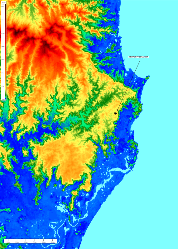
Digital Elevation Model
The Shuttle Radar Topography Mission (SRTM) obtained elevation data over Australia in 2000. The 1 second (30m) data was released in late 2011. |
|
|