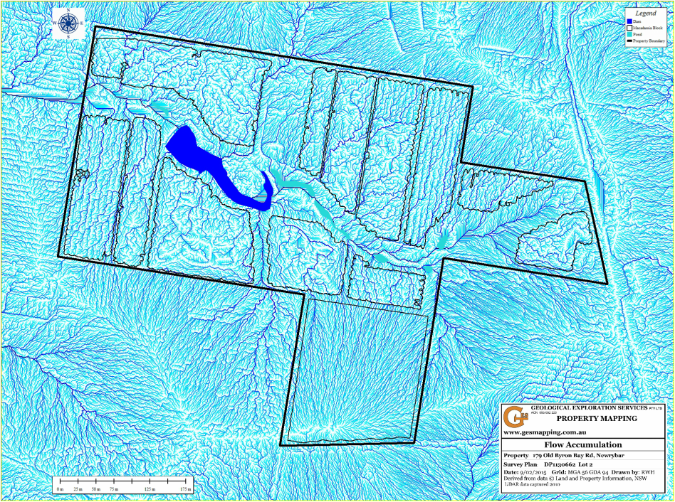
Flow Accumulation
The drainage network is created by natural erosion over time and is governed by topography (slope gradient), geology and rainfall. The map is useful for water management showing location and relative concentrations of water flow.
The map is generated by the 8 direction pour point model on the 1m grid digital elevation model.