Erosive Potential
Erosion of soil by water reduces its productive potential by removing nutrients and removing topsoil, particularly organic matter. Run-off will occur when rainfall intensity is greater than the infiltration rate. The slope of the land and the length of the slope both affect the risk of erosion by changing the quantity of water in surface flow and the speed of flow. The map highlights areas of potential erosion that need to be managed.
Slope Length/Gradient Factor – LS Factor
The slope length–gradient factor, LS-factor, describes the combined effect of slope length and slope gradient on soil loss. It is the ratio of soil loss per unit area at any particular site to the corresponding loss from a specific experimental plot of known length and gradient.
LS-factor numbers are site specific and can be calculated from digital elevation models generated from lidar. Numbers > 1 are of concern for any cultivated soil and > 2 for any soil without ground cover.
The map below was generated from the output of the lsfac_exe C++, an array based executable program written by:-
Van Remortel, R.D, Maichle, R W, Hickel, R J (2004) Computing the LS factor for the revised universal soil loss equation through array-based slope processing of digital elevation data using C++ executable. Computers & Geosciences 30 (2004) 1043-1053
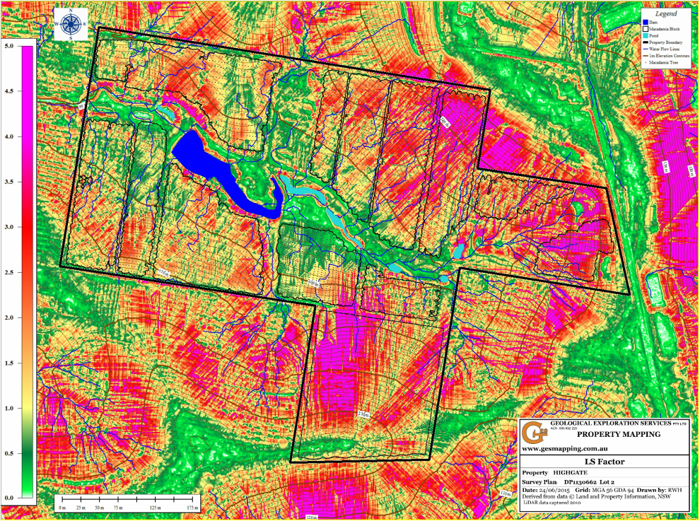