Geological Exploration Services
  • Home
  • What is LiDAR
  • LiDAR Coverage
    • LiDAR Coverage
    • NSW
    • Qld
  • The advantage of digital maps
  • Map Gallery
  • Products
    • Products
    • Location 1:250,000 scale
    • Location 1:25,000 scale >
      • Historical Parish Map
    • Farm Plan
    • DP Plan / Survey Plan
    • Orthophoto Map
    • Digital Elevation Model
    • Slope Map
    • Aspect Map
    • Geology
    • Soil Map
    • Landscape Map
    • Flow Accumulation
    • Water Catchment
    • Flow Direction
    • Revised Universal Soil Loss Equation
    • Erosion Potential
    • Flood Map
    • Vegetation
    • Canopy Height
    • Lidar Ground Point Density
    • Canopy Intensity
    • Tree Block Map
    • Tree Variety Map
    • 3D models
  • Prices
  • Contact
  • Using the maps for farm productivity
  • Examples
  • Downloads
Flow Direction

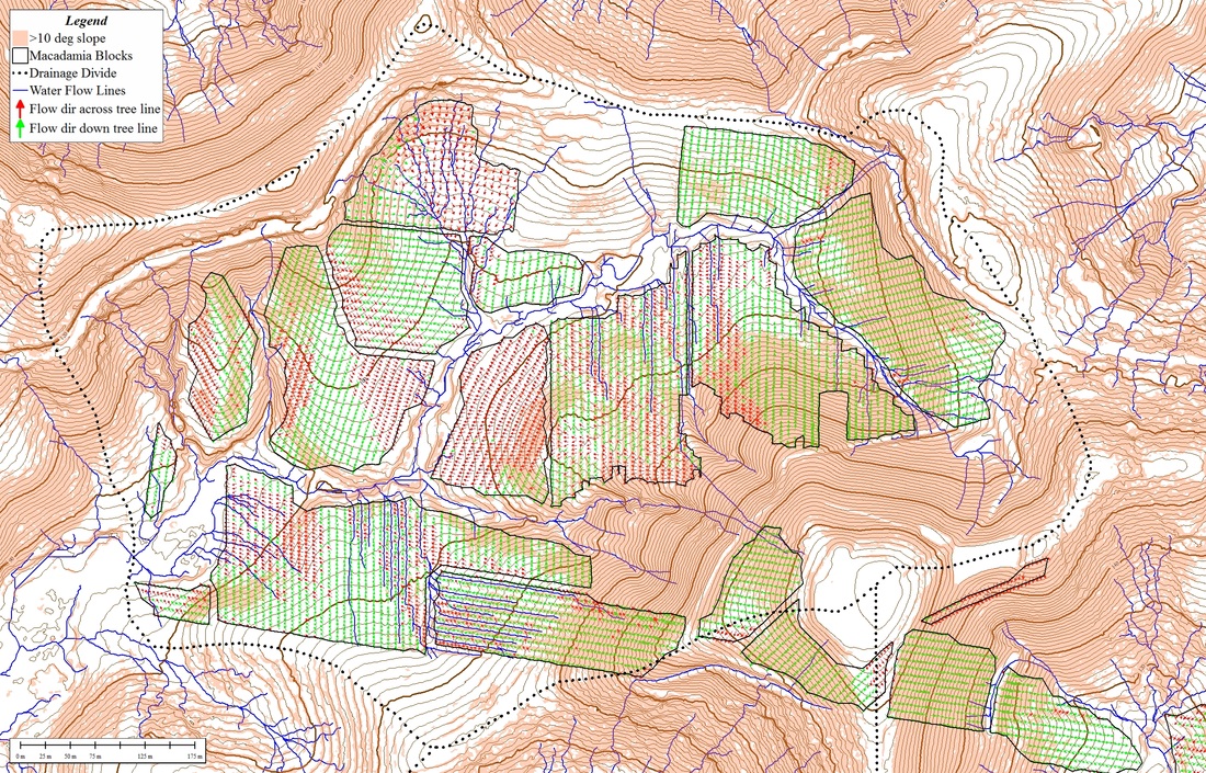
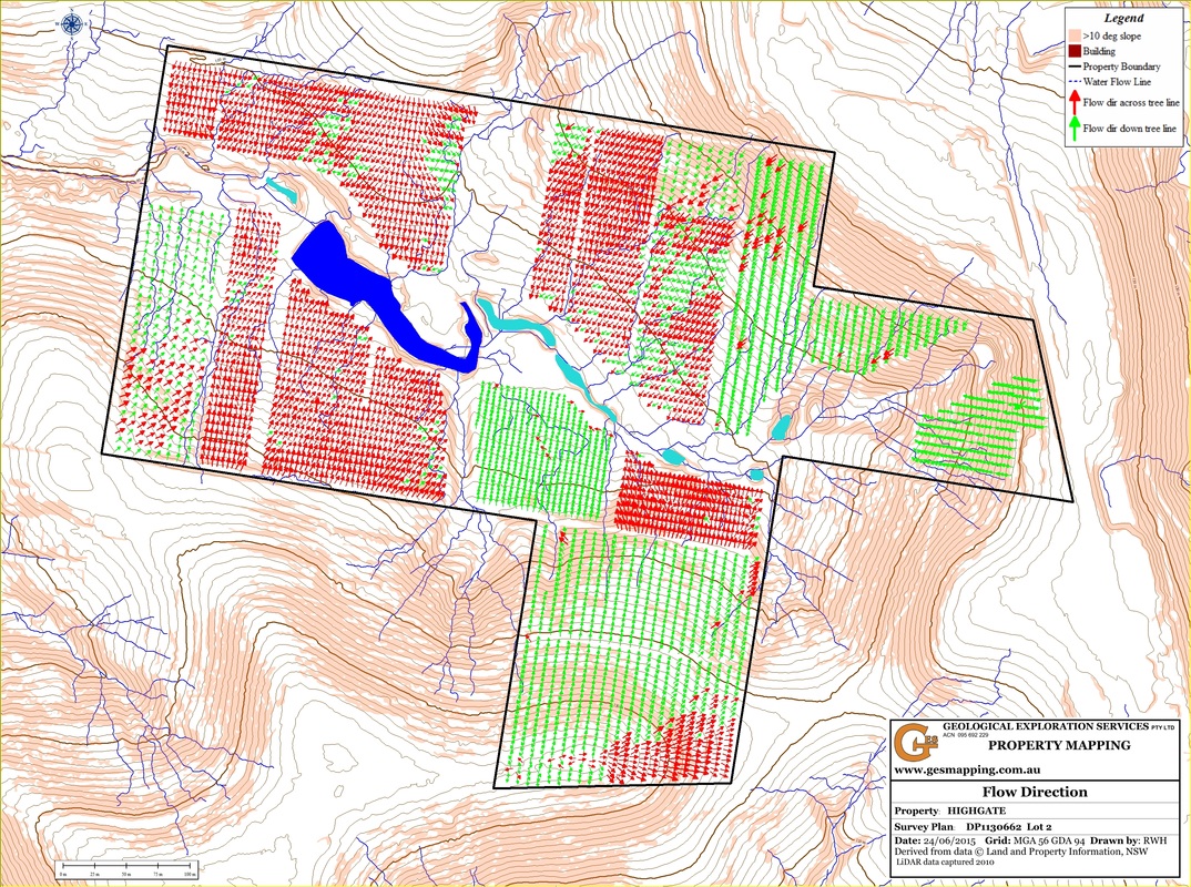
The Flow Direction map is directed towards orchards that need to manage the water flow within orchard blocks. In the map all trees are represented by an arrow that points directly down slope showing the direction of water flow. The arrows are colour coded depending on if the flow is down the tree line (green) or across the tree line (red). Areas of predominantly green arrows are best managed by profiling and the areas of red arrows should rely on contour drains.
Picture
Picture
  • Home
  • What is LiDAR
  • LiDAR Coverage
    • LiDAR Coverage
    • NSW
    • Qld
  • The advantage of digital maps
  • Map Gallery
  • Products
    • Products
    • Location 1:250,000 scale
    • Location 1:25,000 scale >
      • Historical Parish Map
    • Farm Plan
    • DP Plan / Survey Plan
    • Orthophoto Map
    • Digital Elevation Model
    • Slope Map
    • Aspect Map
    • Geology
    • Soil Map
    • Landscape Map
    • Flow Accumulation
    • Water Catchment
    • Flow Direction
    • Revised Universal Soil Loss Equation
    • Erosion Potential
    • Flood Map
    • Vegetation
    • Canopy Height
    • Lidar Ground Point Density
    • Canopy Intensity
    • Tree Block Map
    • Tree Variety Map
    • 3D models
  • Prices
  • Contact
  • Using the maps for farm productivity
  • Examples
  • Downloads